 The “Anello del Limarò” connects the Upper Garda with the Lakes Valley and in only 56 km it allows to enjoy a varied and significant part of Trentino.
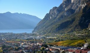
The tour starts in Arco, conventionally from the parking lot near the Sarca river.
From here, following the road signs for the center, we cycle along the road situated near the wonderful Arco gardens, which leads us to the village of Varone. Here is where the climb of the Ballino Pass starts. It is a rather easy climb: about 16 km with a height difference of about 600 meters.

The road (SS241) is uphill with hairpin turns until you reach villages of Gavazzo and then Cologna: here you deserve a break to admire, from the panoramic point near the cemetery, the wonderful view over the valley: Arco but also Riva del Garda and Lake Garda. Then, we’ll continue our itinerary and, after about 3 km, we’ll reach the village of Tenno with its castle overlooking the small hamlet: unfortunately it is not possible to visit it as it is privately owned.
The road continues to Ville del Monte: from here I recommend taking the detour to the village of Villa Canale. The village dates back to 1211 and is classified among the most beautiful villages in Italy. Very characteristic for its little square and cobbled streets, the village has a museum of the tools of peasant life and the “House of Artists” dedicated to the painter Giacomo Vittone.
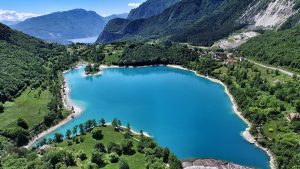 Back on the main road, after about 2 km, we’ll reach Lake Tenno, formed (probably in 1100) as a result of the landslide of the Ville del Monte hump, which blocked the course of the lake’s tributary. During summer, it is possible to bathe in the lake, which is now risking the drain: in fact, the central island has become a peninsula connected to the mainland.
There are only 5 km left to the Ballino pass: the road rises with “steps” but with accessible slopes. Before reaching the pass, we’ll arrive in the homonymous village of Ballino where I recommend stopping to admire a view of the pretty little church of Saint Lucy and to drink some fresh water at the fountain you’ll find there.
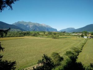 Once you’ve reached the pass, after a descent full of turns, you will find a level land, the so-called “piana di Fiavè“, where there is a biotope and an archaeological site dedicated to the Palafitte di Fiavè. We’ll start again our itinerary, crossing the villages of Stumiaga, Dasindo, Vigo Lomaso and Ponte Arche. From here, following the road signs for Trento, after about 1 km, we’ll find the Terme di Comano.
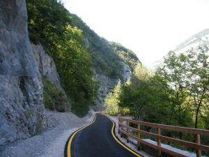
The road then begins to climb again, slightly sloping, to another flat land leading to the entrance of the bicycle lane, located on the right before the tunnel. The cycle lane passes through the so-called “Limarò“, a sort of forge that develops between Ponte Arche and Sarche, tracing the old road which, before the construction of the tunnels, was the only way of communication between the valleys of Sarca and Giudicarie. After crossing the bridge over the Sarca river, on the right, we’ll find another section of cycle lane which, passing near the river, leads to Pietramurata.
 From here, following the indications for the cycle lane and crossing the characteristic “marocche” characteristics, you’ll reach the old “Centrale di Fies” and, cycling surrounded by vineyards and apple trees, you reach the village of Dro. One you’re in the village, you need to continue to follow the directions for the cycle lande and head to the village of Ceniga.
Once we’ve reached the destination of the itinerary, the only thing left is cycling our way back to the car.
Copyright photo 1: www.lagodigardaescursioni.it
Copyright photo 2: wikipedia.org
Copyright photo 3: www.vitadonna.it
Copyright photo 4: www.archeotrentino.it
Copyright photo 5: http://www.news.giudicarie.com