It is true that beach season, hot sunny days, colorful umbrellas and boat trips only last a few months, but what Cinque Terre has to offer lasts the entire year. Since 1997, along with Portovenere, it has been a Unesco World Heritage Site and has so much to offer the visitor beyond just a pretty beach.
Cinque Terre
Cinque Terre has a vast network of paths that branch off above the villages and offer hikers a unique vantage point without getting too far from the sea.
Reaching the villages is very easy thanks to the railway network that connects them to each other. With the Cinque Terre Card, you can reach the five villages with a single ticket. If you’d like to visit Portovenere as well, a bus will take you right to the famous Church of St. Peter.
Portovenere
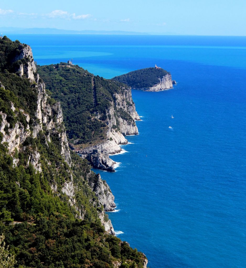
From Piazza Bastreri to Portovenere, for example, the path AV5T (Alta Via delle 5 Terre) begins with a staircase, which initially runs along the walls of the Doria Castle of Portovenere, and then turns into a beaten earth and rock path. It takes you through the forest, all the while keeping the sea in sight. Within a few hundred meters, you’ll reach an altitude that will provide you with a view of Portovenere and Palmaria Island. We are now in Muzzerone, mainly known for rock climbing and its refuge which has a spectacular view.
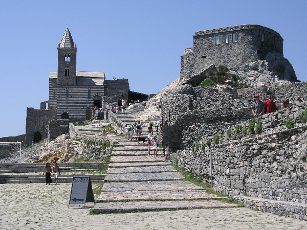
The trail, which crosses the Portovenere Natural Park and the Cinque Terre National Park, continues in the direction of Campiglia. On this stretch of the trail, observant hikers will be able to see the Church of St. Peter camouflaged in the rocks behind them in the distance.
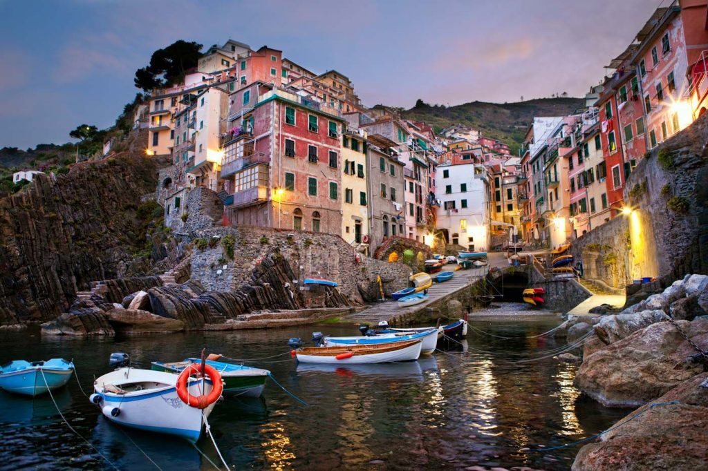
Riomaggiore
From Campiglia, you can still see the sea from the main square of the village in front of the church, but only after crossing the pine forest where the remains of a windmill, dating back to the seventeenth century, are located. Going north and keeping to the left side at Telegrafo, you’ll follow the blue-green path where a long descent will lead you down to sea level. Along the way, you’ll pass the Sanctuary of Monte Nero with its terrace just above Riomaggiore, the first village of the Cinque Terre. You’ll descend a lengthy staircase among the vineyards that will lead you to Riomaggiore’s main street with its colorful buildings.
The proposed itinerary starts from sea level, exceeds 500 m between Campiglia and Telegrafo and returns to sea level in Riomaggiore. The 12 km hike can be completed in 5 hours time. This is the perfect hike to experience the culture, natural beauty, and cuisine of these spectacular villages.
Copyright photos: wikipedia.it; cinqueterre.com
Article written by: F. Malpezzi