Monte Baldo is the highest mountain around Lake Garda and, with its extension, it dominates almost the whole eastern coast. The massif offers many opportunities for outdoor enthusiasts.
For cyclists, it’s truly paradise! The wonderful “Monte Baldo Tour” will wind you through fabulous landscapes between the provinces of Trento and Verona.
I should point out that it would be better to do this tour on weekdays (the road is popular among motorcyclists), avoiding the month of August as the return from “Gardesana Orientale “ (SS 249) may be a little hectic due to traffic. In addition, you’ll need front and rear signaling lights as well as reflective vests in order to cycle in the tunnels between Malcesine and Torbole in total safety.
You’ll start from the little square of Torbole (62 meters above sea level) and from here take the so-called “Vecchia Nago”, which will take you to the village of the same name in just 2 km. Do not underestimate this first climb which, even if it isn’t that long, has some pretty intense slopes.
Follow the cycle path until you reach the San Giovanni Pass (287 meters above sea level) passing through Loppio and Mori (204 meters above sea level).
At Mori, after the cycling track, after about 500 meters you’ll reach the roundabout where you’ll start your ascent towards Monte Baldo: about 24 km with an altitude of almost 1,500 meters.
The road begins to climb immediately with a rather significant slope, reaching Besagno (383 meters above sea level) and then to Brentonico (692 meters above sea level), surrounded by the beautiful panorama of the Lagarina Valley.
Once you’ve reached Brentonico you can finally catch your breath as the road turns slightly and then descends for about 500 meters, but it’s just an illusion because the road suddenly plunges to reach a 16% slope!
It continues on with some more hairpin bends to the village of San Giacomo (1,196 meters above sea level).
And even here, after a short descent, you’ll have to deal with another, very hard, yet panoramic stretch, which leads to the village of San Valentino (1,314 meters above sea level) where the pass by the same name is located.
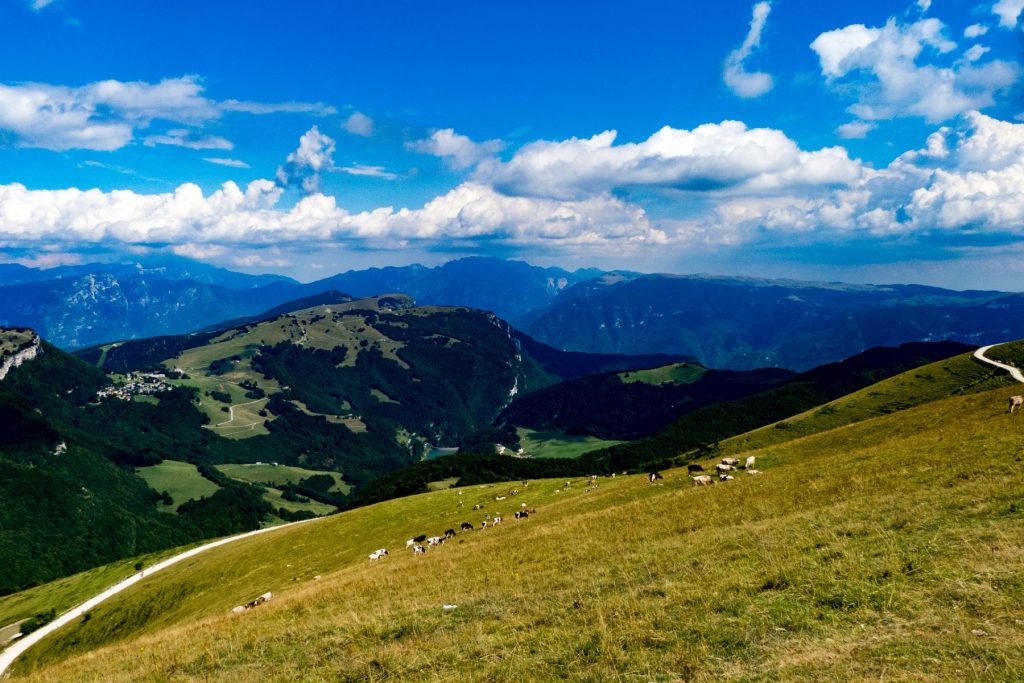
You can drink from the newly-built fountain before facing the last 6 km which leads to the Graziani mountain-hut (1,617 meters above sea level) among vast pastures and small huts.
The road just reaches the hut and then starts to descend towards the Bocca di Navene mountain hut (1,403 m. meters above sea level) from which you can enjoy a wonderful view over amost all of Garda.
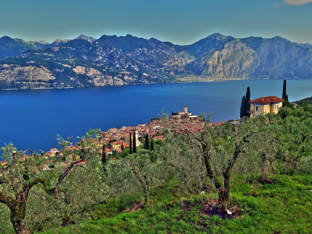
But the hard work is not over: the road continues for about 10 km until you arrive in the village of Novezza where the true descent starts. It appears initially narrow and steep, but then it becomes wide, nosediving to Caprino Veronese village. Here the landscape changes completely: from the meadows and flowers typical of the high mountains to Lake Garda with its Mediterranean vegetation.
Caprino is the turning point: here, following the indications for the village of Garda, after about 4 km on a straight road (called “linea”), you’ll reach Lake Garda. Once in the village of Garda, make sure to stop for an ice cream to recharge your batteries. There is still 35 km to go along the “Gardesana Orientale” to Torbole!
If your return trip is after midday, it is particularly pleasant thanks to the “Ora del Garda”, the typical wind of this lake which comes from the Po Valley. In the early afternoon hours, it starts as a gentle breeze and gradually strengthens until sunset. An interesting fact: the term “Ora” comes from the Latin word “aura” which means “breath”. In the morning “Ora” is preceded by Pèler, the wind blowing from north to south and ending around noon.
When all is said and done, you cannot help but feel tremendous satisfaction (and maybe, a bit sore) from the 155 km and almost 2,500 meters of altitude that you have just completed! Bravo!
Copyright photo 1: lavitanostra.net
Copyright photo 2: gardaoutdoor.files.wordpress.com
Copyright photo 3: visitmalcesine.com