The most suggestive scenery of South Tyrol is the Sciliar Dolomites and the Siusi Alps. Inhale and exhale. Savor the atmosphere. The purity and clarity of the air are already enough to convince any mountain lover to stay for days! Immersed in one of the most spectacular and scenic places in Italy, the Sciliar Natural Park also encompasses much of the enchanting Alpe di Siusi plateau.
A UNESCO World Heritage Site
These two protected areas – together with all the other massifs in the Dolomites – were declared a UNESCO World Heritage Site on June 26, 2009. They represent two of the most characteristic and well-kept natural areas in the Trentino region, more precisely in South Tyrol.
The Alpe di Siusi takes its name from the small town below (Siusi) near Castelrotto and occupies a large area of 52 square kilometers that extends from Val Gardena and the Sassolungo Group to Siusi. The majestic backdrop of the Sciliar massif is part of the Sciliar-Catinaccio Natural Park, a protected area of 6,796 hectares.
The lowest point of the park is represented by the populated area of Saltria, at 1,680 meters. Monte Petz is one of the highest peaks at 2,563 meters although the Marmolada glacier reaches an altitude of 3,343 meters.
Beautiful Year-Round
At the first whiff of pure air, visitors will be won over, but if that isn’t enough, then the out-of-this-world scenery and outdoor activities will do the trick. Whether it be winter or summer, with friends or with family, you will certainly find what is right for you. There are dozens if not hundreds of fabulous excursions in the summer. Wintertime offers snowboarding and skiing, luxurious hotels, or characteristic refuges nestled in the Dolomites. Local cuisine, horseback riding, and visiting castles are just some of what the area has to offer.
Getting There
Getting to the Alpe di Siusi (and consequently to the Sciliar) is not difficult at all, but there are a couple of things to watch out for. The natural park is located a few kilometers above Bolzano, precisely between the villages of Castelrotto and Siusi. From the A22 motorway in Bolzano Nord, follow the signs for Castelrotto or for the Alpe di Siusi itself, passing through the villages of Fié and S. Costantino.
Siusi
After about fifteen kilometers, you’ll reach Siusi (before Castelrotto), where you can stay either in a hotel or camp. Exactly halfway between Siusi and Castelrotto is the beginning of the 16 kilometers of hairpin turns that wind up to the Compatsch plateau. Since the Alpe di Siusi and the Sciliar are protected natural parks, the road that takes you there is closed to normal traffic from 9 in the morning until 5 in the afternoon. This rule also applies if you have rented a house or are staying in one of the hotels or lodges on the plateau (unless it is the day of your arrival).
Compatsch
If you are an early riser, then it won’t be a problem- just reach the Compatsch before nine and park in one of the paid lots. If, on the other hand, you want to laze a bit and enjoy a typical South Tyrolean breakfast, you can take one of the many buses that reach the Alps or go up on the cable car. It’s not exactly cheap but it is a small price to pay for the amazing scenery that is uncontaminated by excess traffic.
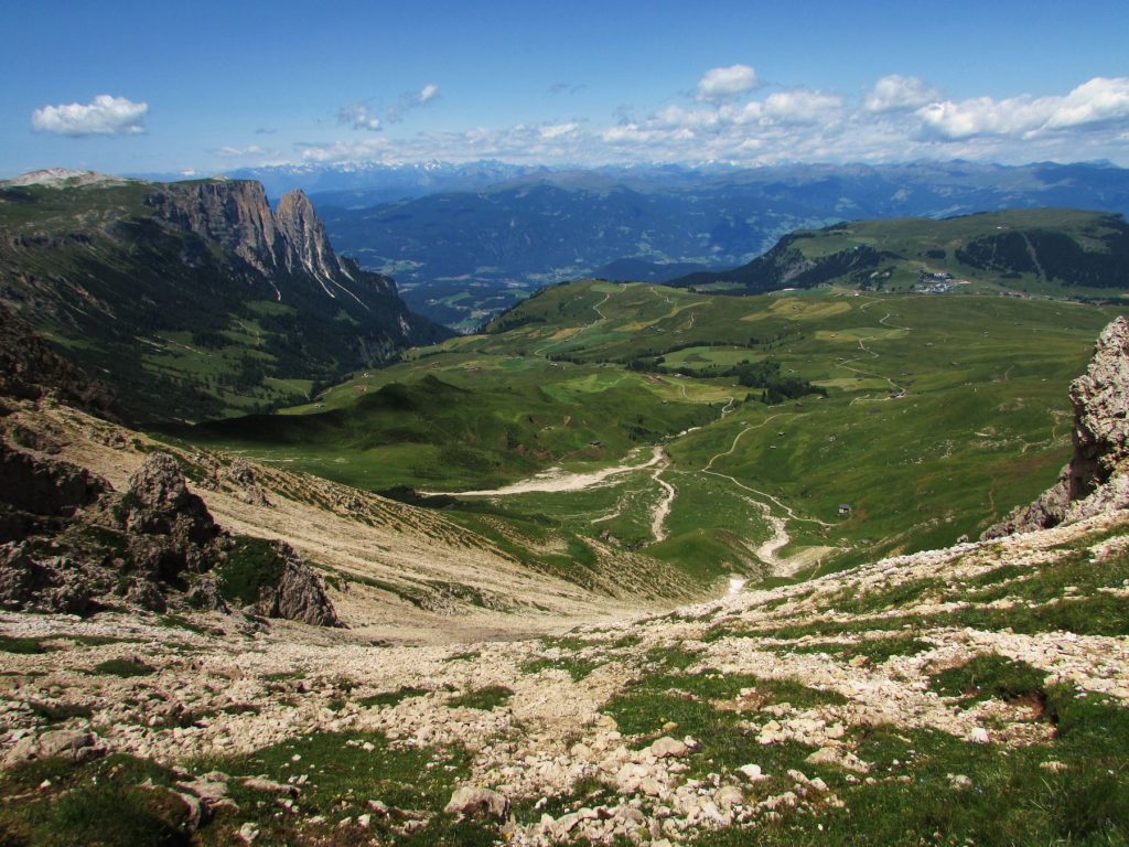
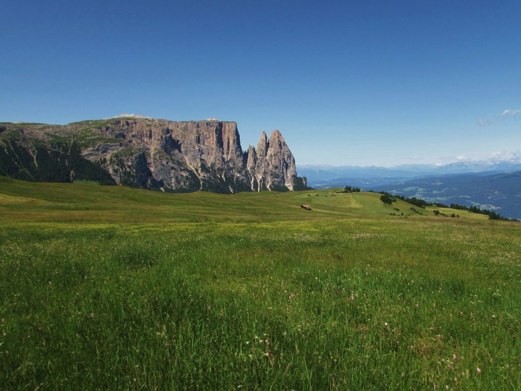
Once you arrive at the Compatsch (which is a small neighborhood made up of elegant hotels and typical chalets, shops and restaurants), you will enjoy an extraordinary view. On the right stands the famous profile of the Alpe di Siusi, dominated by the Santner and Euringer peaks, and by the Sciliar massif which stretches up to the Denti di Terrarossa. Gaze to the left and you will find the majestic Sassolungo and Sassopiatto Group, near the Sella massif.
Excursions
For those who love nature and hiking, it will be hard to choose from the numerous options. If you only have one day then the two best routes are the Molignon refuge and the Tires or Bolzano refuge.
Molignon Refuge
The first hike is on well-kept terrain and suitable for everyone (even children). It stays even throughout the hike although the altitude is 2,050 meters.
Getting to Molignon is very simple: from Compatsch you can take the cable car to the Panorama refuge or walk towards the next refuge, the Laurin. In both cases, you will be in the center of the Alpe di Siusi where the 360-degree view will be spectacular. Here – be it Laurin or Panorama – very clear indications are in both Italian and German. In about an hour and ten minutes, you’ll reach your destination, passing through the Golden Horn (in German Goldknopf) and the Almrosen Hutte.
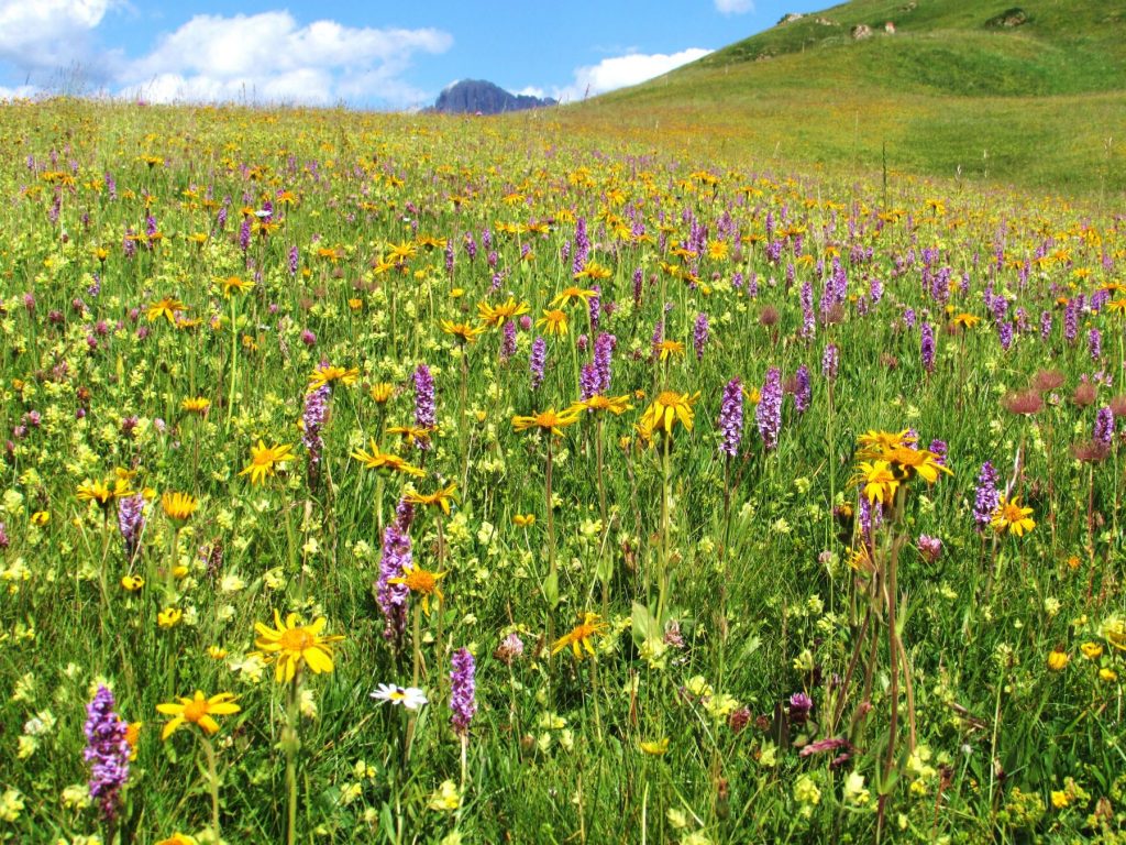
Once you arrive at Molignon, you will find a tailor-made refuge for families and for those who want to relax, with green meadows, excellent food, marmots, and even a pond. Anyone wishing to extend the tour can go down towards Saltria following the 12 A, a road immersed in the woods, and go up towards Compatsch. Or just before the Golden Horn, take the grassy path that leads to the foot of the climb to Tires, from where you can enjoy a complete view of the plateau.
Bolzano/Tires
The second excursion (known as the Bolzano/ Tires tour) is longer and more demanding, suitable for more experienced people, but worth every drop of sweat since it allows you to discover the entire Sciliar massif and have one of the most beautiful views of the area.
Arriving by chairlift or walking from the Laurin refuge, you’ll have to reach the Spitzbuhl refuge (well known as being a starting point for paragliding flights) from where you’ll take the detour to the Saltner hut, at the foot of the Sciliar massif. From here, following the signs for the Bolzano refuge, a demanding climb of about an hour and twenty minutes to reach the top awaits you, where the view will be simply spectacular.
At your feet – 500 meters below – you will have the entire green Alpe di Siusi plateau, on the right the imposing Sassolungo and Sassopiatto Group while looking east towards the Denti di Terrarossa you can admire the entire Sciliar massif. With an additional bit of effort, you can reach Mount Petz (2,563 meters) for a view of Punta Santner from an unusual perspective.
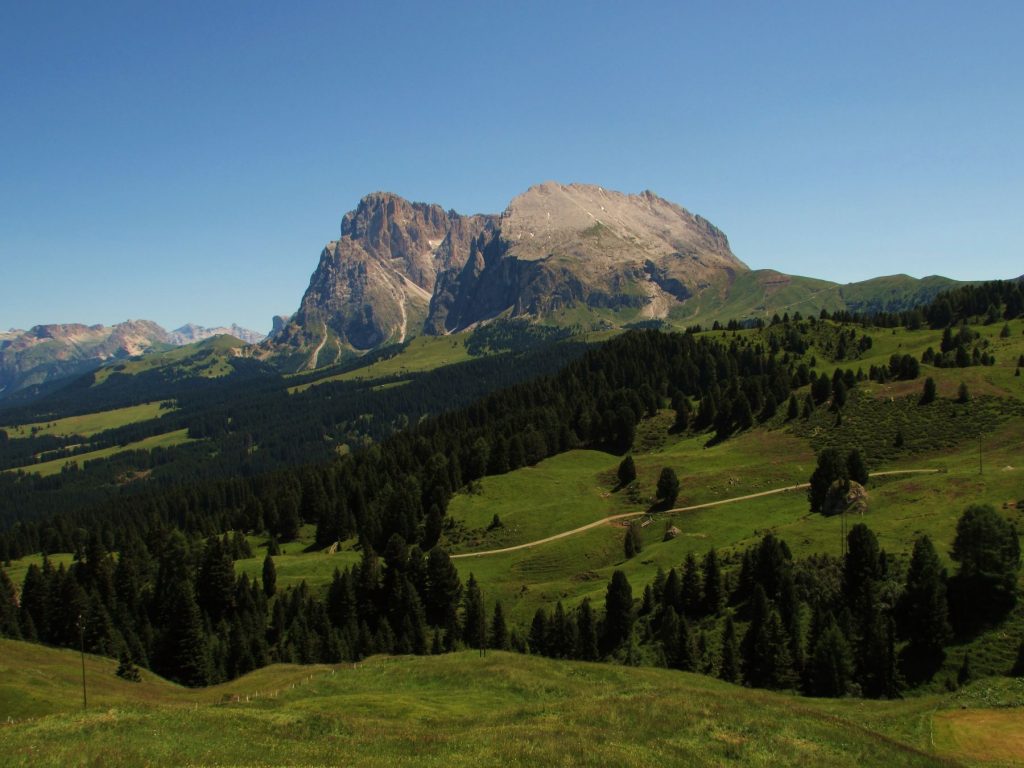
After resting at the Bolzano refuge, continue along the trail to Tires. In about an hour and forty minutes, you’ll arrive at this historic refuge with a red roof. The view is fantastic and gives you a glimpse of the famous Catinaccio Group (or Rosengarten), which at sunsets turn pink and red. Exercise caution because this is a very challenging trail.
Once past Tires, everything becomes simpler: from the fork shortly after the refuge the view is again impressive. You will be able to clearly see your climb and after this point, it will essentially be all downhill to the Laurin or the Compatsch, which you will reach in just over two hours. You will have to go down a gravelly zigzag path, up to a meadow (full of marmots) which will come out exactly on the aforementioned grassy path before the Goldknopt. From here it will be a matter of minutes before you reach the Compatsch. The trail is about 6-7 hours of walking depending on your pace and starting point, but hiking through these two natural parks is well worth it.
Winter Sports
In wintertime, you can take advantage of skiing and snowboarding and lots more. The snow park was voted the best in Italy, and with its 175 kilometers in total (and 80 ski lifts) the ski area is no different. The scenery is magical at this time of year.
In addition to skiing and snowboarding, you can try ski mountaineering, sledding slopes, horse-drawn sleighs and snowshoeing. After a day on the slopes, you can relax in one of the charming hotels, possibly with outdoor spas.