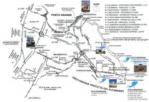
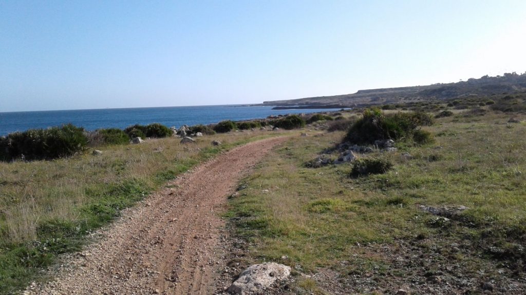
Plemmyrion is the ancient name given to the Magdalen Peninsula located south of the Great Harbor of Syracuse by Virgil in the Aeneid (III, 692/5) and, mentioned even earlier, by the Greek historian Thucydides in his History of the Peloponnesian War (Book VII, 4) which narrates the conflict that arose between the Athenians and the Syracusans. Currently the name Plemmirio refers to the whole territory surrounded by the Plemmirio Marine Nature Reserve which was established in 2004. More specifically, it refers to the district that overlooks the Costa Bianca, the coast facing south. The Magdalen Pathway begins just beyond the last block of buildings at the end of Via degli Zaffiri, located in the Plemmirio district. This route, to be covered on foot, with good trekking shoes, or by mountain bike, runs for about 10 km and crosses an unspoilt area, completely void of urban settlement. In several places the path is marked with green and white signs connecting it to the road network at various access points, and dividing into segments that could be easily visited on different days.
The dwarf palm, whose scientific name is Chamaerops humilis, can be considered the very symbol of Plemmirio due to its vast presence along the coastal strip. Large areas of the palms dominate most of the coastal strip as far as Punta del Gigante. Only in its final stretch, near Punta della Mola, do the lush fields of dwarf palms thin out, leaving room for other varieties of bushes. Along the way, getting off the beaten track, you can wander endlessly among its countless bushes which form interminable labyrinths. They grow rather close together, but not so much as to prevent passing between. Among the varieties of palm trees present in the area, the dwarf palm is the only endemic species. It is counted among the species of Mediterranean scrub. Its dried pinnate leaves are used as bristles in the manufacturing of small brooms by tying them and shaping them around a broom handle. They are useful in scraping off debris from the surface of brick ovens.
The Furrow and Capo Murro di Porco
Beyond the barrier at the end of Via degli Zaffiri, we follow the road for about 100m, then we take a dirt path that, after a few meters, leads us to a long natural furrow that slopes almost to the sea level breaking the monotony of the high cliffs. After that we continue along the dirt path for about 400m and then turn right onto the asphalt road that ends 200m in front of the Lighthouse of Capo Murro di Porco. This lighthouse, active since 1959, sits on a white polygonal tower and is about 20m high. In clear conditions its light can be seen over 30 km away.
The Fissures
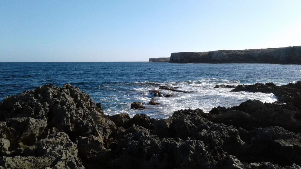
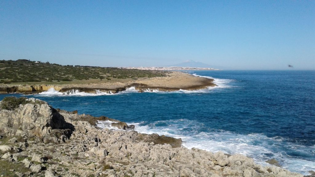
The coast of Capo Murro is characterized by high cliffs that go down to the sea. Near the coastline we can observe deep fissures that criss-cross the cliff from side to side. If you visit this area when the sea is rough, you can witness a unique natural phenomenon. If the wind conditions are right, the sea water penetrates the fissures and shoots out at the top, forming spectacular jets of water similar to geysers.
Coastal Battery Lamba Doria
Once we get back to the road, we reach the crossroad where a sign indicates access n.30 to the Marine Nature Reserve of Plemmirio (Capo Murro di Porco). At this point we continue straight, following the internal road and, 30m before the stop sign, located between the Strada Capo Murro di Porco and Via Mallia, we take the dirt road. On the right side you can see the barracks, which housed the soldiers of the coastal battery Lamba Doria. Proceeding along the path, we find the naval gun emplacements, whose firing range allowed them to keep the entire Gulf of Noto under control. It extends from Capo Murro di Porco up to Capo Passero, and also contains underground storage, pillboxes and tunnels. The entire complex covers a total area of 48,000 square meters and is located between 34 and 20m above sea level. The coastal battery was built by the Italian Engineer Corps at the end of the 1930s and was part of the garrisons belonging to the Augusta-Siracusa stronghold. Neutralizing the Lamba Doria was one of the very first targets of the Operation “Ladbroke”, which began the Allied invasion of Sicily: in the early hours of 10th July 1943 it was attacked and overwhelmed by the British Special Raiding Squadron led by Major Paddy Mayne. Despite its current state of neglect, the complex still largely maintains its original appearance.
Retracing our steps back to the intersection where the sign indicated access n.30 to the Marine Nature Reserve of Plemmirio (Capo Murro di Porco) , we take Via Capo San Vito and proceed along the asphalt road that ends shortly after. From here we take Magdalen Pathway, turning immediately right at the end of the boundary wall on the right side, and we proceed towards the sea which leads to the pond. This area, although modest in size, is a crucial water resource and an important stopover site for the numerous migratory birds that fly across the Plemmirio area.
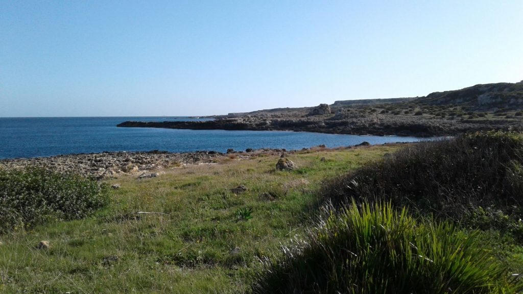
Elephant Rock and Punta Tavernara
We continue along Magdalen Pathway heading north for about 1 km, then we head right and go down the path. A large esplanade opens up at the end announcing our arrival at Punta Tavernara, formed by a three-point limestone cliff. Approaching the extremity of the north-eastern tip and looking towards Capo Murro di Porco we see the Elephant Rock, whose rocky ledge descends to the sea, forming an arch: named for its resemblance to the head of an elephant with its trunk immersed into the seawater.
Cala Pellegrina
Continuing along the climb, until we meet up again with the Magdalen Path, we continue for about 650m until we find ourselves back at the access n.32 junction which descends to Cala Pellegrina. Here we turn right and continue our descent until we arrive at the inlet of Cala Pellegrina: on the eastern side there is a large, partly submerged cave and just in front of that a small, natural platform that emerges from the sea. Other small rocks emerge from the sea nearby.
Punta del Gigante and the Stone Quarry on the Northern Inlet
From Cala Pellegrina we come back to the crossroad from which we descended and we follow the Magdalen Pathway for 500m. Where the path splits, we keep to the right until we reach a 6m high rock spur. At its foot, the remains of a dry stone wall enclose a small flat area. This is the closest point to the tip of Punta del Gigante, where we can admire the coastline. We return to the rock spur behind us, then continue along Magdalen Pathway for 400m, along an inlet that brings us to its northern slope. There we find an ancient stone quarry that looks like a natural swimming pool slightly above sea level.
Cave of Pillirina
We retrace the path 150m back to the fork where, keeping to the right, we take the innermost path and proceed for 40m, along the dry stone wall on our right side. At this point, a gap in the wall allows us to climb over the low fence, to turn right and to start the climb towards the cave. We proceed for 200m, keeping to our right side a second dry stone wall. By following it to its end, we’ll find ourselves in front of the entrance of the Pillirina Cave. This karstic cavity is of particular interest due to the presence of a narrow and low tunnel which leads to a lateral cavity, adorned with stalactites and stalagmites. It should be noted that the connecting tunnel progressively narrows and, at a certain point, you must crawl along the ground in order to access the innermost part.
Punta Tavola and the White Shores
After visiting the cave, we descend to resume the Magdalen Pathway. From the point where we met the path that allowed us to climb to the cave, we proceed towards Punta Tavola which we reach after 1.5km. Along the way, make sure to look out at the coastal stretch of the White Shores or Rive Bianche, named for the particular clarity of its water. Along the shoreline you can see unique spongy formations which give the reef a bright white color. On the stretch of coast immediately before the promontory, we find the so-called Punta Tavola beach formed by a large flat cliff.
Punta della Mola and Cala Massolivieri
From Punta Tavola we continue along the path, and in 400m we find ourselves at Cala Massolivieri located on the western side of Punta Tavola. Visible one meter under sea level, we can observe the second stone quarry on the coast. The high white cliffs overlooking the sea dominate the landscape. At the junction with the promontory of Punta della Mola, at the foot of the cliffs, is the small golden sandy beach of Cala Massolivieri, listed among the most beautiful beaches in Italy. Punta della Mola is renowned for its intense mining activity over the years. In fact, it’s Plemmirio’s largest stone quarry with two large outcrops on opposite slopes of the promontory. Since Greek times the fine limestone blocks, once extracted, were transferred by boat to their destinations: the ancient Greek temples of Apollo and Athena, and, more recently, the facade of the Syracuse Cathedral.
Coastal Battery Emanuele Russo
Located in a strategic position to defend the entrance to the Great Harbor of Syracuse, the coastal battery Emanuele Russo of Punta della Mola is a contemporary of the Lamba Doria of Capo Murro di Porco. Although the area of the defensive complex covers a less extensive area than the Lamba Doria, the Emanuele Russo constituted a garrison of fundamental importance for the protection of the city. Unlike the Lamba Doria, which was the scene of fighting, the coastal battery the Emanuele Russo, equipped with anti-ship artillery, machine guns, warehouses, barracks, offices and underground tunnels, was abandoned by the defenders before being surrounded and attacked by the enemy units.
The Silos of Punta della Molla
These cylinder-shaped hollows were carved out of the rock during Greek times and probably used for grain storage. They were then converted into furnaces for hydraulic lime manufacturing during the Roman Empire.
Punta Castelluccio
From Punta della Mola we can admire Punta Castelluccio, which marks the extreme edge of Plemmirio. On the promontory at the top of the red tower there is an active lighthouse that was installed in 1864. The rhythmic signaling is visible from about 16 km away in clear conditions. Punta Castelluccio has a long, narrow sandy beach on the side facing Punta della Mola.
The Costa Bianca of Plemmirio, the Bay of Terrauzza and Punta Milocca
The southern coast of the Magdalen Peninsula offers a splendid view over the Gulf of Noto that extends for 30km up to Capo Passero. Along this coastal area the accesses to the Marine Nature Reserve of Plemmirio are located from n.22 to n.29. From La Rosa sul Mare up to Capo Meli, the cliff is just above sea level, allowing easy access to the water as well as between accesses n.22 and n.23. From Capo Meli up to the seafront of Via degli Zaffiri, the coastline rises progressively, allowing access to the sea. Getting there: along the Strada di Capo Murro di Porco you can reach the Costa Bianca from entrance n. 22 (wheelchair accessible), from Via dell’Onice (entrance n. 23), from Via delle Perle, which, after 70m, continues into Via dei Diamanti (entrances n.24-26) or from via degli Zaffiri (entrances n. 27-29).
La Tonnara and the Bay of Terrauzza
Coming from the lighthouse of Capo Murro di Porco from the Capo Murro di Porco Road, at the first roundabout after 3 km, take the second exit to the Traversa Tonnara. After 200m on our left we see the ruins of the eighteenth century Tonnara of Terrauzza (tuning fishing net). According to the account of Annalena Lippi Guidi in her Tuna Fishing Nets of South-Eastern Sicily, the rooms facing the street were inhabited by fishermen and a large open gallery on the sea side held the entrance to the tools depot. In the inner courtyard a small garden and an orchard were cultivated, while the shore below served as a shelter for boats and “muciares”. Inside the complex there was a large upper floor that was the home of the owners. The establishment experienced a period of prosperity in the early twentieth century, so much so that it was considered the second most important tuna fishing net of Syracuse. In the following decades the business went into decline until its closure. The remains of large hawsers, materials used to fix the fishing nets, and even the anchors are still visible. The latter are found in the dive site called The Wall of the Three Anchors, which can be reached from access n. 29 of Via degli Zaffiri. The small beach on the bay of Terrauzza is situated at entrance n.21 of the Marine Nature Reserve of Plemmirio (Capo Murro di Porco) and consists of a thin strip of gray sand 10m wide and 30m long. Although for most of the year tall masses of decomposing seagrass cover the entire beach.
Fanusa Beach and Punta Milocca
Fanusa Beach is a small sandy stretch sheltered by the promontory of Punta Milocca and can be reached from entrances n.2 and n.4 of the Marine Nature Reserve of Plemmirio. Proceeding towards Punta Milocca, the beach becomes more pebbly and rocky. On the opposite side of Punta Milocca, coming from Via Marco Polo, a narrow coastal pathway leads to the small natural area of Punta Milocca. Getting there: at the roundabout where you enter the Traversa Tonnara, continue straight ahead for 2.7km then turn left onto Via Cristoforo Colombo. Continue until you reach the junction with Via Marco Polo. Numerous crosswalks on the right side allow access to the sea at different points.
Milocca Tower: this watchtower was built around 1467 for protection from the raids of Barbary pirates. It was damaged by the violent earthquake of 1693, then rebuilt in 1697. In the past, the door located at the first level was the only entrance and was connected to the external staircase by a drawbridge. Inside, only the ground floor preserves its original structure, due to the fact that after the seventeenth century, the threat had passed and the tower was converted to residential use. Getting there: at the roundabout take the Traversa Tonnara, continue straight ahead for 3.7km, passing the intersection of the Traversa Pozzo di Mazza and the Traversa Renella, until you reach the intersection of the Traversa Pozzo di Mazza and Provincial Road 104, then turn right and after 200m turn right again. The Tower is private and cannot be visited.
Translation Provided by: The Academy